Monday, June 10, 2013

Port Of West Sacramento, USA


The Port of West Sacramento is in the center of one of the world's richest agricultural regions. The Port of West Sacramento is an inland port about 146 kilometers northeast of the Port of San Francisco, and cargo ships get to the Port of West Sacramento by traveling through the San Francisco Bay and up the Sacramento River. The Port of West Sacramento exports bagged and bulk rice, cement, lumber, fertilizers, and project cargoes like wind generators.

The indigenous Maidu people inhabited the region around the Port of West Sacramento before Spanish explorer Pedro Fages arrived there in the 1770s and named the river for Christian religious sacraments.

The Port of West Sacramento became a hub of transportation on the river when John Sutter started a steamer service, and the Port of West Sacramento was a terminus for the Pony Express and the first railroad in California.

The original idea to create an inland port is credited to Major Paul Norboe in 1916. He began to advocate for a deep water channel and harbor with the State and the Sacramento Chamber of Commerce. In the early 1900s, the Sacramento River was dredged, giving ships seasonal access from the Port of West Sacramento to the Pacific Ocean.

In the 1930s, William Stone, the "Father of the Port," continued to push for a deep-water port to bolster the city's economy. He got the US Army Corps of Engineers to take a second look at the potential for a deep-water port, and they proposed to construct a 43-mile channel.

The project was approved by the US Congress in 1946, and the port district was created. Voters created the Sacramento-Yolo Port District, and the groundbreaking took place in 1949. The project was completed in 1960, making the Port of West Sacramento year-round deep-water port.

Friday, June 7, 2013

Port Of Acapulco, Mexico


On the west coast of Mexico, 300 miles south of Mexico City, a natural harbor is the setting for this beautiful city on the bay. This 4 mile stretch, lined by beaches and framed by mountains offers views that are nothing short of spectacular! Billed as Mexico’s first resort, during the 50’s and early 60’s, Acapulco was THE playground of the rich and famous. 

Pollution, over-commercialization and corruption tarnished its image and its popularity declined. In recent years Acapulco has experienced a resurgence, however, and it is once again becoming a popular destination for those who love late night dinners at fabulous restaurants, dancing until dawn at glitzy discos and lounging on sun-drenched beaches all day. Inhabited for thousands of years by Aztecs, Acapulco was originally the center of the fishing and trading industry. Who would have ever imagined it would become a flashy resort city that pulses with 24-7, non-stop energy.

Port of Acapulco is a popular cruise and non-cruise tourist destination. The port is the destination for tourists sailing between Panama and San Francisco and it offers a panoramic view of the beach with a somewhat circular bay where ships dock (even as early as the 16th century). The port is just walking distance away from the best sites in Acapulco which is known for busy nightlife fun (i.e. dancing and drinking). The port is a favorite of celebrities who love the cuisine, non-stop dancing and glittering hang outs. Considered as a sun and sand destination for great holidays, Acapulco offers activities that you will surely enjoy and will make you come back for more.

Saturday, May 4, 2013

Port Of Davao, Philippines


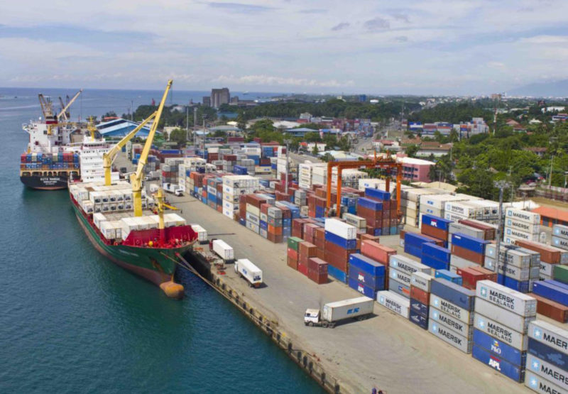
The Port of Davao is on the Philippines’ Mindanao Island at the mouth of the Davao River as it enters the Davao Gulf. Protected by Samal Island, Davao City is a regional center for Davao Region, although it is administratively independent of any province. It contains as many as 50 small commercial ports, and its major seaports are some of the busiest in the southern Philippines.

The Port of Davao is a deep-water facility at Sasa about eight kilometers northeast of Davao City’s port for smaller vessels at Santa Ana. The Port of Davao handles inter-island passengers and cargoes that include copra, maize, and rice. Its international export traffic is primarily abaca, the main agricultural product in the region. Davao City and the Port of Davao are becoming the main center for tourism, business, and investment in the southern Philippines. In 2000, over 1.1 million people lived in Davao City.


The Philippine Ports Authority (PPA), Port Management Office (PMO) Davao, is a government corporation responsible for funding, managing, and operating the country’s public ports. The organization’s charter also requires it to implement an integrated port system to promote maritime trade and to help transform the Philippines into an industrialized country.
In order to meet this goal, the PPA plans to modernize at least ten ports by the year 2010, improve port services, reduce client costs, integrate both community development and environmental protection into port development and operations, and provide a positive and productive working environment for port employees.

In 2007, more than 21.5 thousand vessels called at the Port of Davao, including 1760 foreign vessels. The Port of Davao handled almost 9 million tons of cargo in 2007, including 5.0 million tons of foreign cargo, 3.9 million tons of domestic cargo, and 64.4 thousand tons of transshipments. While the Port of Davao welcomed more than 105.9 thousand passengers in 2007, other government ports in Davao City handled 1.4 million passengers.

The Port of Davao handled 3.9 million tons of imports/inbound cargoes and 5.1 million tons of exports/outbound cargoes. Of the total 9 million tons of cargo moving through the port in 2007, containers accounted for 4.0 million tons, breakbulk cargoes were 3.1 million tons, and bulk cargoes were 1.8 million tons.

PMO Davao, the Port of Davao’s management office, considers Sasa Wharf to be its base port. Most commercial cargoes and passengers are handled about ten kilometers from the city center at Sasa Wharf. PMO Davao has regulatory responsibility for several municipal ports and 18 private ports within the Davao City metropolitan area. The Port of Davao has trade relationships with the ports of Hong Kong and Singapore and with countries that include China, Australia, the Middle East, Europe, and the United States.


Davao City and the Port of Davao do not suffer typhoons. The weather is balmy throughout the year, with no real dry or wet season. Temperatures range from 20°C (68°F) to 30°C (86°F). Many people in the Philippines believe that Davao City and the Port of Davao are the most crime-free areas in their country. The people and the police look after tourists.
Mount Apo is the tallest mountain in the Philippines, standing over 10 thousand feet above sea level. This volcanic peak covers 72.8 hectares and is covered with natural wonders. “Apo” means grandfather, and tribal legend says the mountain is god’s domain. Visitors to the Port of Davao’s Mt. Apo will find geysers, sulfur pillars, a steaming blue lake, three rivers with tall waterfalls that boom as they fall, and rainwater lakes.


Friday, November 23, 2012

Port Of Callao, Peru

The Port of Callao is Peru's main commercial seaport. Just 12 kilometers from downtown Lima (Spanish), the country's capital, the Port of Callao is part of the Lima-Callao metropolitan area. The Port of Callaois 765 kilometers northwest of Peru's southern Port of Matarani and 960 kilometers southwest of the relatively isolated Port of Iquitos on the Amazon River in the country's far northeast region. The Port of Callao has one of South America's few good natural harbors on the Pacific Ocean. In 2005, almost 390 thousand people lived in the Port of Callao, although the Lima-Callao metropolitan area is home to more than 8.4 million.

The Port of Callao lies south of the Rimac River at the tip of a peninsula protected by the offshore island of San Lorenzo and a promontory. The Port of Callao exports mainly refined metals, minerals, fish meal, and fish oil. Its principal imports are wheat, lumber, and machinery. The Port of Callao is home to a wide range of industries that include breweries, fish meal factories, and shipbuilding yards. The Port of Callao is also home to a large naval base and the Jorge Chavez International Airport. It is also the site of several islands that support a large colony of sea lions and seabirds in a relatively pristine ecosystem.

Peru's National Port Authority (Spanish) (APN) governs all ports in Peru, including the Port of Callao. The Empresa Nacional de Puertos S.A. (ENAPU) was created by law in 1970 as a decentralized public organization under the Transports and Communications Sector. ENAPU was made responsible for operating, maintaining, and administering all terminals and jetties in the Republic of Peru.

ENAPU seeks to be the leading container port on South America's Pacific Coast, and the Port of Callao plays a vital role in that leadership. Both competing and cooperating with the private sector, ENAPU provides appropriate port infrastructure, modern equipment, and skilled workers to offer the best port services available. ENAPU is committed to meeting the demands for port services effectively, efficiently, and reliably to support the development of foreign trade in Peru and the integration of the Port of Callao-Lima region.


La Empresa Nacional de Puertos ENAPU S.A. administers and develops the Port of Callao under state ownership. The Port of Callao serves a vast hinterland that contains Lima, Huanuco, Cerro de Pasco, Ayacucho, Huancavelica, and Junin. Located in the Pacific Basin on Peru's central coast, the Port of Callao holds an important strategic position on the inter-oceanic routes for vessels crossing the Panama Canal and the Straits of Magellan.

The Port of Callao serves Peru's capital city of Lima and the rest of the country through a network of roads that extend to the north and south and into the central mountain region. The Port of Callao is connected by road with the Jorge Chavez International Airport, located about four kilometers northeast of the Port of Callao, and to the nation's railroad that crosses the Andes Mountain range.

Saturday, November 17, 2012

Port Of Auckland, New Zealand


The Ports of Auckland is on the North Island of New Zealand. Ports of Auckland is located some 345 kilometers northwest of the Port of Napier and over 500 kilometers north of the Port of Wellington, two other ports on the North Island. Auckland is New Zealand's largest city and seaport. It is one of few cities with harbors on two different water bodies. The Ports of Auckland rests on a narrow strip of land between Waitemata Harbor to the east and Manukau Harbor to the southwest. In 2006, over 404 thousand people lived in the city of Auckland, and over 1.2 million called the urban area home.

The Ports of Auckland is the economic center of New Zealand, and most large international corporations have offices there. Its central business district contains many financial and business service companies, while the industrial and commercial zones are located in South Auckland along the Tamaki River estuary and the Manukau Harbour. The Ports of Auckland is a hub of road and rail transportation, and it is home to the country's main international airport. The Ports of Auckland area contains important engineering and publishing companies, and its manufacturers produce glass, paint, plastics, cement, and a host of consumer goods. Food processing, sugar refining, and brewing are important to the local economy, as are vehicle assembly and shipbuilding.

In 1863, the worst maritime disaster in the history of New Zealand made clear the limitations of the Ports of Auckland's Onehunga port. A 1700-ton steam corvette, the HMS Orpheus, struck the Manukau Bar at 1:30 in the afternoon. By 9pm, the mast disappeared below the water surface. Out of 250 passengers, only 70 survived.

In 1871, the Auckland Harbour Board was established by an act of Parliament. An elected board and a permanent staff administered the Ports of Auckland. In 1875, an act of Parliament gave the Board more than two thousand hectares of the seabed in Waitemata Harbor.

As cargo volume increased, the Board made significant improvements to the Ports of Auckland including reclaiming lands on Auckland's foreshore. Better Ports of Auckland dockyards were established, and a new railway wharf was added. By the end of the 19th Century, the Ports of Auckland was also a busy passenger port with travelers bound for Sydney, San Francisco, and London.

In the early 20th Century, developments were completed between the modern Princes Wharf and Kings Wharf in the Ports of Auckland. In 1913, the Auckland Harbour Board became responsible for the management and operation of the Manukau Harbour and the Onehunga Port. Within the Auckland area, the wooden Queen Street Wharf was replaced by concrete, and the Marsden Wharf was completed. The Ports of Auckland's Captain Cook Wharf opened in 1922. The Prince of Wales visited Auckland in 1921, and the Princes Wharf was completed in 1923. By 1931, the Western Reclamation and Western Wharf extension were finished.

During World War II, part of the United States' Pacific fleet was based in the Ports of Auckland. Over 100 warships and 280 transporters called at the Ports of Auckland in 1943, and the need for more storage facilities became apparent. The Ports of Auckland engaged in near-constant reclamation work to cope with the increasing demand.

In 1948, the Bledisloe Wharf in the Ports of Auckland was opened to handle frozen cargoes for export. In the 1950s, cargo volumes moving through the Onehunga port increased, and the growth continued into the mid-1960s. Dedicated to imports, Auckland's Jellicoe Wharf was finished in 1952, and the Freyberg Wharf was completed in 1961.

During the 1960s and 1970s, the shipping industry went through major changes as new technology and machines replaced labor-intensive operations. Containerization was revolutionary. In 1971, the Ports of Auckland's Fergusson Container Terminal was built to handle containers, and the Bledisloe Wharf was converted for containerized cargoes. In 1971, the Columbus New Zealand, called at the Ports of Auckland Fergusson container terminal and was unloaded using the first ship-to-shore container crane in the country. The Onehunga port began handling containers in 1982.

In 1988, New Zealand's Parliament passed legislation to change the structure of port management. Ports of Auckland Limited was formed, and it purchased the land and assets of the Auckland Harbour Board and took over commercial port operations. Listed on the New Zealand Stock Exchange, the Auckland Regional Authority owned 80% of the shares, and the Waikato Regional Council owned 20%. During its first years, the Ports of Auckland increased efficiency and productivity dramatically.

The Ports of Auckland has continued to work to improve productivity and efficiency since the early 1990s, and capacity has continued to increase. New container cranes were added in 2001 and 2006, and the Ports of Auckland has focused on rail and supply chain solutions. In 2002, the first inland port at East Tamaki was opened by the Ports of Auckland. In 2005, the Ports of Auckland opened another inland port at Wiri in South Auckland.

The Ports of Auckland has continued to do reclamation work at the Fergusson Container Terminal. In 2003, efforts began to deepen the shipping lane and to expand the terminal by 9.5 hectares. The new shipping lane opened in 2007, and the first phase of the terminal extension was finished in 2007.

Ports of Auckland has also been moving gradually towards the east, opening over 70 hectares of land to alternative uses since 1996. In 2007, the land in the Western Reclamation was transferred to the Wynyard Quarter redevelopment. Ports of Auckland Limited was delisted from the Stock Exchange in 2005, and Auckland Regional Holdings, an arm of the Auckland Regional Council, owns 100% of the company today. Profits are reinvested in the region to support infrastructure and stormwater control projects.

Today, the Ports of Auckland is the country's biggest international container port. The Port operates 24 hours a day throughout the year and services over 1700 ship calls, 4 million tons of breakbulk cargo, and over 770 thousand TEUs of containerized cargo each year. The Ports of Auckland is responsible for ensuring an efficient supply chain for containers and developing container hub operations. Near the busy and growing industrial area of South Auckland, the Ports of Auckland continues to get a constant flow of vessels carrying coastal goods as well as the local fishing fleet.

With water area of 394 square kilometers, the Ports of Auckland's Manukau Harbour is one of the largest inlets on New Zealand's west coast. Unfortunately, navigation is limited due to the numerous tidal sand bars, including a curving sand bar that stretches across the harbor entrance, making it very narrow.