Thursday, March 29, 2012

Port Of Melbourne, Australia

The Port of Melbourne is Australia's second biggest city and the capital of the State of Victoria. Located at mouth of the Yarra River where it enters the northern end of Port Phillip Bay, the Port of Melbourne is about 33 nautical miles from the Port of Geelong across the Bay and about 727 kilometers southwest of Sydney. In 2006, over 3.5 million people lived in Greater Melbourne.

The Port of Melbourne is the busiest seaport in Australia, handling almost 40% of the country's container traffic, and home to much of the country's automotive industry. It is also an important manufacturing, financial, and business center. The Port of Melbourne is an increasingly-important center for technology, with more than 60 thousand people employed in the information and communications technology sector. With headquarters for two of the country's four major banks, the Port of Melbourne is an important financial hub for the Asia-Pacific region. The Port of Melbourne also has a busy tourism industry that hosted more domestic tourists than Sydney in 2008.

The Port of Melbourne Corporation is the port authority that recently took over the functions of the former Melbourne Port Corporation. The Port of Melbourne's port authority is responsible for managing the channel and shipping activities. The Corporation conducts hydrological surveys of the waters of the Port of Melbourne, plans and supervises contracts for dredging of the commercial properties and maintaining navigational shipping aids in the port, and creating the strategic plans for future commercial shipping in the Port of Melbourne.

The Port of Melbourne contains 34 commercial berths and two modern international container terminals. The Port of Melbourne's multi-purpose berths handle a wide range of cargoes that includes motor vehicles and timber. The specialized berths in the Port of Melbourne handle dry cargoes that include grain, cement, gypsum, sugar, and fly ash. The specialized liquid cargo berths handle cargoes that range from petrochemicals and crude oil to molasses.

Dedicated to container traffic, the Port of Melbourne's Swanson Dock berths can accommodate vessels to 290 meters long with maximum draft of 12.1 meters. The Swanson Dock East is 884 meters long, and the Swanson Dock West is 944 meters long.

The Appleton Docks in the Port of Melbourne are a total of 984 meters long with alongside depths of 11.4 and 12 meters. Handling general cargo, Appleton Docks B, C, and D can accommodate vessels to 250 meters long with maximum draft of 10.1 meters. Handling containers, the Port of Melbourne's Appleton Dock E can accommodate vessels to 126 meters long with maximum draft of 10.1 meters. Appleton Dock F, a common user berth for general cargo, can accommodate vessels to 228 meters long with maximum draft of 10.8 meters.

Also a common user berth handling general cargoes, the Port of Melbourne's Victoria Dock is 315 meters long, and its berth can accommodate vessels of 250 meters in length with maximum draft of 8.8 meters.
The South Wharf at the Port of Melbourne offers seven berths with total length of 914 meters and alongside depths from 9.4 to 11.6 meters. Handling bulk cement, Wharf 26 is 266 meters long and can accommodate vessels to 215 meters long with maximum draft of 10.4 meters. South Wharves 27, 28, and 29 are each 146 meters long and can accommodate vessels to 215 meters in length with maximum draft of 8.8 meters. South Wharves 28 and 29 are common user berths. Wharf 28 handles bulk cement, and Wharf 29 handles direct-to-road transport cargoes only. Wharves 30 and 31 are used only by tug boats. South Wharf 33 contains two cement terminals and a common user berth of 210 meters in length that can accommodate vessels to 185 meters long with maximum draft of 11 meters.

The berth at the Port of Melbourne's Yarraville 5 Dock specializes in bulk sugar and gypsum cargoes and is 148 meters long. It can accommodate vessels to 180 meters long with maximum draft of 8.8 meters. The Yarraville 6 Dock contains two berths of 205 and 220 meters in length. The 205-meter long berth handles bulk cargoes and can accommodate vessels to 180 meters long with maximum draft of 10.2 meters. The 220-meter long berth is a common user berth for bulk cargoes, and it can accommodate vessels up to 180 meters with maximum draft of 7.5 meters.

Wednesday, March 28, 2012

Port Of Le Havre, France

The Port of Le Havre lies on the right bank of the Seine estuary as it enters the English Channel about 106 nautical miles south-southeast of Southampton in Great Britain. The Port of Le Havre is also located some 216 kilometers west-northwest of Paris and 85 kilometers west of the Port of Rouen. In 2004, some 184 thousand people lived in the Port of Le Havre.

The Port of Le Havre is France's second port after Marseille. Much of the traffic passing through the Port of Le Havre is crude oil, but the Port of Le Havre is also important for its ship repairs and its ferry services to England and Ireland. The Port of Le Havre supports a large industrial zone that contains oil-refining, chemical, petrochemical, cement, automotive, and aeronautical industries. The Port of Le Havre contains growing service and administrative sectors and a growing tourist trade.

The Port Authority of Le Havre is a state agency responsible for managing the port. The Port of Le Havre is France's second busiest port and the fifth biggest port in Northern Europe. It is the largest container port in France and a major oil port, handling some 40% of France's crude oil cargoes. The Port of Le Havre is a multi-purpose commercial port with a wide range of terminals that can process all types of cargo. The Port of Le Havre also serves passengers traveling between the United Kingdom and France as well as passengers aboard international cruise vessels.

The port authority controls the movement of ships arriving and departing the Port of Le Havre as well as movements within the Port of Le Havre. It employs state-of-the-art facilities and technologies to assure the safety and efficiency of port operations and makes information available over the Internet for port customers' convenience. The Port of Le Havre authority also polices the harbor area, monitors dangerous goods, and organizes pollution control activities.

In 2006, the Port of Le Havre handled more than 74.4 million tons of cargo, including 54.3 million tons of imports, 19.5 million tons of exports, and 630 thousand tons of cabotage. The largest single cargo category was crude oil (over 34.2 million tons). The Port of Le Havre also handled some 22.6 million tons of general cargo, 21.1 million tons of which was containerized. The Port of Le Havre handled 11.4 million tons of refined products. Other major cargo groups included coal (2.9 million tons), liquid bulk (1.4 million tons), and solid bulk (1.3 million tons).

Imports passing through the Port of Le Havre in 2006 were dominated by 34.2 million tons of crude oil, 10.6 million tons of general cargo (including almost 10 million tons of containers), and 5.4 million tons of refined products. Other major import categories included coal (1.7 million tons), solid bulk (1.2 million tons), and liquid bulk (643 thousand tons). Port of Le Havre exports were dominated by general cargo (including 11.1 million tons of containers) and refined products (6.0 million tons). The Port of Le Havre also served some 265 thousand ferry passengers in 2006.

The Port of Le Havre covers an area that extends 27 kilometers from east to west and, at its widest, five kilometers from north to south. The Port of Le Havre covers more than ten thousand hectares and includes zones dedicated to sea traffic and to industry-related port activities. The Port of Le Havre includes more than two thousand hectares of environmentally-protected lands within the nature reserve of the Seine Estuary.
Access to the Port of Le Havre is provided by a diverse infrastructure. A shipping canal serves the industrial complex that can accommodate the largest trans-oceanic liners. A river channel connects the Port of Le Havre to the River Seine. The Port of Le Havre also has direct links to the nation's highway, railway, and inland waterway networks.

Port of Le Havre pilots must be on board of any ship over 70 meters long or carrying dangerous goods. Pilotage is not required for ships traveling the English Channel or North Sea; however, it is available and recommended.

Port Of Kobe, Japan

The Port of Kobe lies on the northwestern shores of Osaka Bay in west-central Honshu, the main island of Japan. Capital of Hyogo prefecture, the Port of Kobe is about 10 nautical miles west-northwest of the Port of Osaka and some 140 kilometers southwest of the Port of Nagoya. The combined cities of Kobe and Osaka are Japan's second largest urban area, and the Port of Kobe is Japan?s sixth largest city. In 2005, more than 1.5 million people lived in the Port of Kobe.

The Port of Kobe has been one of Japan's most important ports for many years. In addition to its role in maritime commerce, the Port of Kobe is home to major steel and shipbuilding industries. Other important industries in the Port of Kobe include the manufacture of small appliances, food products, and communications and transportation equipment. The city is linked with the rest of the nation by a complex network of rail lines, including those serving the famous Shinkansen bullet trains, and expressways. When it was opened in 1998, the Port of Kobe?s Akashi Kaikyo Bridge was the longest suspension bridge in the world.

The Kobe City Government is the Administrator of the Port of Kobe, and the Kobe Port Terminal Corporation (KPTC) builds, leases, and maintains the terminals where companies can rent dedicated terminals. The Kobe Port Administrator manages the port and harbor area facilities for common users. The Kobe Port Administrator established the Kobe Port Terminal Corporation in 1891. The KPTC constructs foreign trade and ferry terminals; leases, maintains, and improves the terminals; and builds, maintains, and controls facilities related to the foreign trade and ferry terminals.

In 2007, the Port of Kobe served 3849 vessels and over two million TEUs of containerized foreign trade cargoes.

The Port of Kobe is located in an enviable location on major international sea routes that connect more than 500 ports in 130 countries and regions around the world. The Port of Kobe also has many domestic routes throughout western Japan. The Port of Kobe is more than a commodity distribution center. It is a popular recreation area for residents and popular cruise ship destination. When the Kobe Airport opened in 2006, a ferry service between the Port of Kobe and Kansai International Airport began operating, making Kobe a hub for sea, air, and land transportation.

The Port of Kobe?s role in international ocean-borne trade is clear in the 83 routes and 346 calls per month that travel through the port. The Port of Kobe the westernmost of Japan?s big five ports, making it the first port for imports and the last port for exports on the intra-Asian sea routes. China is the port?s biggest trading partner, with 77 container routes connecting the two countries with more than 81 sailings per week. The?Port of Kobe is linked to Japan?s western regions by coastal feeder and ferry services to 26 ports with 66 sailings per week.

Port Of Santos, Brazil

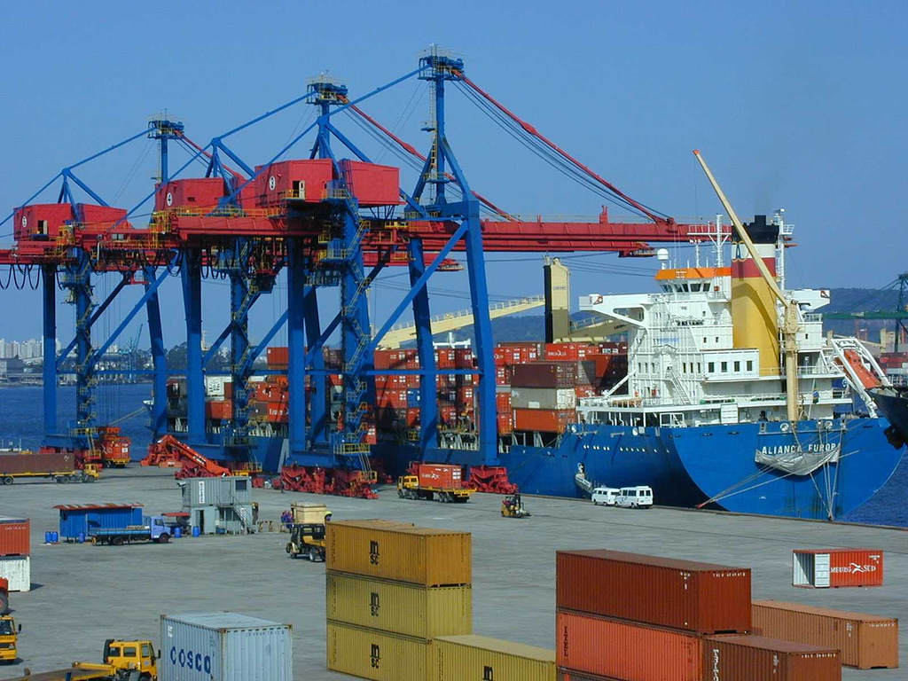
The Port of Santos rests on the alluvial plain of Sao Vicente Island in the State of Sao Paulo in Brazil. It is known to be the busiest port in all of South America, and ranked 39th worldwide. Just a few feet above sea level, a tidal channel cuts the island off from the mainland, and concrete channels drain the swampy island to keep the Port of Santos dry. The city lies on both the island and the mainland. The city lies on the shores of a bay deep enough for the biggest ships and has docks totaling six kilometers in length that can serve 50 ships at once.

The Port of Santos was once considered uninhabitable, but drainage canals, paved streets, and proper sanitation have made it a beautiful place. The nearby resort of Guaruja is popular with Brazilians, and Sao Paulo is only 80 kilometers northwest of the Port of Santos. In 2006, over 418 thousand people lived in the city, and almost 1.5 million called the metropolitan area home.

The Companhia Docas do Estado de Sao Paulo is responsible for managing and maintaining the Port of Santos. In 2006, over 76 million tons of cargo passed through the Port of Santos, with over 5600 vessels carrying over 52 million tons of exports and 24 million tons of imports. These shipments included over 1.6 million TEUs of containerized cargo.

The major cargoes were exports of sugar (12.9 million tons) and soya grains (7.2 million tons), with smaller quantities of pellets, alcohol, fuel oil, and orange juice. Coffee exports in 2006 were over 926 thousand tons. Major imports through the Port of Santos included fertilizers (2.3 million tons), wheat (1.4 million tons), and liquefied petroleum gas (520 thousand tons).
The Port of Santos covers more than 7.7 million square meters and contains 9.4 thousand meters of public docks. In 2008, most vessels carried general cargo through the port, while liquid bulk and container vessels also visited the port.


Visitors to the City of Santos (Portuguese) will find many interesting and exciting adventures. The Laje de Santos Marine Park is one of the best scuba diving locations on the coast of Brazil, with depths from 18 to 40 meters that contain reefs, a marine lighthouse, the “cemetery of anchors,” and a sunken fishing boat that is now a nursery for marine life. The Port of Santos’ 19 draining canals are over 100 years old and vary from 50 to 3450 meters long.

The Port of Santos is famous for its beaches. Popular with surfers, the Jose Menino Beach will soon be home to the Pele Museum. Gonzaga Beach is a busy and popular tourist destination with many hotels and the Bandeiras Square. Boqueirao Beach offers all the amenities and hosts an arts and crafts fair on Saturday afternoons. Embare Beach is popular with the young set, and Aparecida Beach is a haven for children where senior citizens have a dance on Saturday afternoons.

The Tip of the Beach at the Port of Santos is a great place to watch the ships moving in and out of the port. On Saturdays, local artists display their work there. You can take the ferry to Guaruja from here or go to Laje de Santos, an ecological reserve, or the Barra Fortress.

The Barra Fortress is an important historic site in the Port of Santos. Located above a 300-meter long beach, sentry towers and the 800-square-meter barracks still stand. Famous for its “Spanish gate” where weapons were stored, the fortress is a favorite spot for tourists.

Port Of Marsaxlokk, Malta

Port of Marsaxlokk (Malta Freeport)  is located on the shores of the Marsaxlokk Bay on the southeastern tip of the island nation of Malta. Malta Freeport is the commercial port for the island and for the fishing village of Marsaxlokk, also one of the most beautiful and quaint seaside locations on the island.

About 10 kilometers south of Malta’s other major port, the Port of Valletta, Marsaxlokk is a major player on Mediterranean ocean-going commercial trade routes. Combining container handling with industrial storage, Malta Freeport is well-known for its no-nonsense business culture and lack of procedural roadblocks.


Home to over three thousand people, the village of Marsaxlokk was used by the ancient seafaring Phoenicians to anchor their ships, and it was the first landing point when the Turkish fleet began the 1565 Great Siege of Malta. The garrison at the 17th Century Fort San Lucjan thwarted a Turkish landing in 1614 (it is now home to the University of Malta’s marine science laboratory). In 1798, French troops disembarked at Marsaxlokk, and remains of the 18th Century fortifications can still be seen. In 1989, US President George Herbert Walker Bush met at Mikhail Gorbachev at Marsaxlokk Bay to discuss the end of the Cold War.

Malta Freeport was established in 1988, and it has grown tremendously since then. Today, it is a major transshipment center for the Mediterranean region.

In 1998, Malta Freeport undertook an organizational restructuring that was completed in 2001. The restructuring greatly improved the port’s operations. Today, Malta Freeport Corporation Ltd. is a landlord and the authority over the Freeport zone. Operating companies have taken over other port activities.
Malta Freeport Terminals Ltd. was created in 2001 as the only operator of the container terminals and warehouse facilities, making clear the distinction between port authority and port operator.

In 2004, the Malta government let a 30-year concession to CMA CGM, a leading worldwide container shipping company, to operate and develop Malta Freeport Terminals. In 2008, the concession was extended to 65 years, with the understanding that Malta Freeport Terminals will continue to be a common-user facility.


Malta Freeport Corporation Ltd. is the port authority for Malta Freeport, and Malta Freeport Terminals Ltd. is responsible for overseeing port operations. Internationally recognized for the quality of service for the high volume of containers it handles, Malta Freeport enjoys international recognition from global shipping lines and other ports. In 2004, Malta Freeport handled 1.5 million TEUs of containerized cargo.
In a clearly important strategic position in the center of the Mediterranean Sea, Malta Freeport has developed the solid infrastructure, outstanding facilities, and state-of-the-art technology to provide the highest standard of service to its customers.

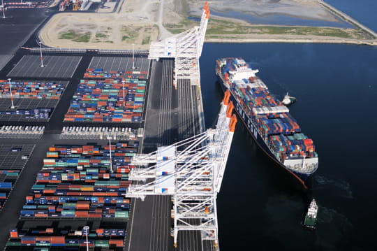
Malta Freeport has several important projects underway to expand capacity and improve productivity so it can maintain its competitive edge in Mediterranean container traffic. The port has acquired five super post-Panamax quayside cranes that have capacity to handle up to 24 containers across the vessel. Infrastructure work on Terminal One includes fitting for rails to accommodate a rail span of 30 meters. Malta Freeport has also purchased a variety of heavy-load quayside equipment and heavy-lift trucks and tractors to expedite cargo handling in the port. At the same time, Malta Freeport is increasing its terminal capacity by developing an additional 100 thousand square meters of land to complement the new Main Gate facility.