Friday, November 23, 2012

Port Of Callao, Peru

The Port of Callao is Peru's main commercial seaport. Just 12 kilometers from downtown Lima (Spanish), the country's capital, the Port of Callao is part of the Lima-Callao metropolitan area. The Port of Callaois 765 kilometers northwest of Peru's southern Port of Matarani and 960 kilometers southwest of the relatively isolated Port of Iquitos on the Amazon River in the country's far northeast region. The Port of Callao has one of South America's few good natural harbors on the Pacific Ocean. In 2005, almost 390 thousand people lived in the Port of Callao, although the Lima-Callao metropolitan area is home to more than 8.4 million.

The Port of Callao lies south of the Rimac River at the tip of a peninsula protected by the offshore island of San Lorenzo and a promontory. The Port of Callao exports mainly refined metals, minerals, fish meal, and fish oil. Its principal imports are wheat, lumber, and machinery. The Port of Callao is home to a wide range of industries that include breweries, fish meal factories, and shipbuilding yards. The Port of Callao is also home to a large naval base and the Jorge Chavez International Airport. It is also the site of several islands that support a large colony of sea lions and seabirds in a relatively pristine ecosystem.

Peru's National Port Authority (Spanish) (APN) governs all ports in Peru, including the Port of Callao. The Empresa Nacional de Puertos S.A. (ENAPU) was created by law in 1970 as a decentralized public organization under the Transports and Communications Sector. ENAPU was made responsible for operating, maintaining, and administering all terminals and jetties in the Republic of Peru.

ENAPU seeks to be the leading container port on South America's Pacific Coast, and the Port of Callao plays a vital role in that leadership. Both competing and cooperating with the private sector, ENAPU provides appropriate port infrastructure, modern equipment, and skilled workers to offer the best port services available. ENAPU is committed to meeting the demands for port services effectively, efficiently, and reliably to support the development of foreign trade in Peru and the integration of the Port of Callao-Lima region.


La Empresa Nacional de Puertos ENAPU S.A. administers and develops the Port of Callao under state ownership. The Port of Callao serves a vast hinterland that contains Lima, Huanuco, Cerro de Pasco, Ayacucho, Huancavelica, and Junin. Located in the Pacific Basin on Peru's central coast, the Port of Callao holds an important strategic position on the inter-oceanic routes for vessels crossing the Panama Canal and the Straits of Magellan.

The Port of Callao serves Peru's capital city of Lima and the rest of the country through a network of roads that extend to the north and south and into the central mountain region. The Port of Callao is connected by road with the Jorge Chavez International Airport, located about four kilometers northeast of the Port of Callao, and to the nation's railroad that crosses the Andes Mountain range.

Saturday, November 17, 2012

Port Of Auckland, New Zealand


The Ports of Auckland is on the North Island of New Zealand. Ports of Auckland is located some 345 kilometers northwest of the Port of Napier and over 500 kilometers north of the Port of Wellington, two other ports on the North Island. Auckland is New Zealand's largest city and seaport. It is one of few cities with harbors on two different water bodies. The Ports of Auckland rests on a narrow strip of land between Waitemata Harbor to the east and Manukau Harbor to the southwest. In 2006, over 404 thousand people lived in the city of Auckland, and over 1.2 million called the urban area home.

The Ports of Auckland is the economic center of New Zealand, and most large international corporations have offices there. Its central business district contains many financial and business service companies, while the industrial and commercial zones are located in South Auckland along the Tamaki River estuary and the Manukau Harbour. The Ports of Auckland is a hub of road and rail transportation, and it is home to the country's main international airport. The Ports of Auckland area contains important engineering and publishing companies, and its manufacturers produce glass, paint, plastics, cement, and a host of consumer goods. Food processing, sugar refining, and brewing are important to the local economy, as are vehicle assembly and shipbuilding.

In 1863, the worst maritime disaster in the history of New Zealand made clear the limitations of the Ports of Auckland's Onehunga port. A 1700-ton steam corvette, the HMS Orpheus, struck the Manukau Bar at 1:30 in the afternoon. By 9pm, the mast disappeared below the water surface. Out of 250 passengers, only 70 survived.

In 1871, the Auckland Harbour Board was established by an act of Parliament. An elected board and a permanent staff administered the Ports of Auckland. In 1875, an act of Parliament gave the Board more than two thousand hectares of the seabed in Waitemata Harbor.

As cargo volume increased, the Board made significant improvements to the Ports of Auckland including reclaiming lands on Auckland's foreshore. Better Ports of Auckland dockyards were established, and a new railway wharf was added. By the end of the 19th Century, the Ports of Auckland was also a busy passenger port with travelers bound for Sydney, San Francisco, and London.

In the early 20th Century, developments were completed between the modern Princes Wharf and Kings Wharf in the Ports of Auckland. In 1913, the Auckland Harbour Board became responsible for the management and operation of the Manukau Harbour and the Onehunga Port. Within the Auckland area, the wooden Queen Street Wharf was replaced by concrete, and the Marsden Wharf was completed. The Ports of Auckland's Captain Cook Wharf opened in 1922. The Prince of Wales visited Auckland in 1921, and the Princes Wharf was completed in 1923. By 1931, the Western Reclamation and Western Wharf extension were finished.

During World War II, part of the United States' Pacific fleet was based in the Ports of Auckland. Over 100 warships and 280 transporters called at the Ports of Auckland in 1943, and the need for more storage facilities became apparent. The Ports of Auckland engaged in near-constant reclamation work to cope with the increasing demand.

In 1948, the Bledisloe Wharf in the Ports of Auckland was opened to handle frozen cargoes for export. In the 1950s, cargo volumes moving through the Onehunga port increased, and the growth continued into the mid-1960s. Dedicated to imports, Auckland's Jellicoe Wharf was finished in 1952, and the Freyberg Wharf was completed in 1961.

During the 1960s and 1970s, the shipping industry went through major changes as new technology and machines replaced labor-intensive operations. Containerization was revolutionary. In 1971, the Ports of Auckland's Fergusson Container Terminal was built to handle containers, and the Bledisloe Wharf was converted for containerized cargoes. In 1971, the Columbus New Zealand, called at the Ports of Auckland Fergusson container terminal and was unloaded using the first ship-to-shore container crane in the country. The Onehunga port began handling containers in 1982.

In 1988, New Zealand's Parliament passed legislation to change the structure of port management. Ports of Auckland Limited was formed, and it purchased the land and assets of the Auckland Harbour Board and took over commercial port operations. Listed on the New Zealand Stock Exchange, the Auckland Regional Authority owned 80% of the shares, and the Waikato Regional Council owned 20%. During its first years, the Ports of Auckland increased efficiency and productivity dramatically.

The Ports of Auckland has continued to work to improve productivity and efficiency since the early 1990s, and capacity has continued to increase. New container cranes were added in 2001 and 2006, and the Ports of Auckland has focused on rail and supply chain solutions. In 2002, the first inland port at East Tamaki was opened by the Ports of Auckland. In 2005, the Ports of Auckland opened another inland port at Wiri in South Auckland.

The Ports of Auckland has continued to do reclamation work at the Fergusson Container Terminal. In 2003, efforts began to deepen the shipping lane and to expand the terminal by 9.5 hectares. The new shipping lane opened in 2007, and the first phase of the terminal extension was finished in 2007.

Ports of Auckland has also been moving gradually towards the east, opening over 70 hectares of land to alternative uses since 1996. In 2007, the land in the Western Reclamation was transferred to the Wynyard Quarter redevelopment. Ports of Auckland Limited was delisted from the Stock Exchange in 2005, and Auckland Regional Holdings, an arm of the Auckland Regional Council, owns 100% of the company today. Profits are reinvested in the region to support infrastructure and stormwater control projects.

Today, the Ports of Auckland is the country's biggest international container port. The Port operates 24 hours a day throughout the year and services over 1700 ship calls, 4 million tons of breakbulk cargo, and over 770 thousand TEUs of containerized cargo each year. The Ports of Auckland is responsible for ensuring an efficient supply chain for containers and developing container hub operations. Near the busy and growing industrial area of South Auckland, the Ports of Auckland continues to get a constant flow of vessels carrying coastal goods as well as the local fishing fleet.

With water area of 394 square kilometers, the Ports of Auckland's Manukau Harbour is one of the largest inlets on New Zealand's west coast. Unfortunately, navigation is limited due to the numerous tidal sand bars, including a curving sand bar that stretches across the harbor entrance, making it very narrow.

Sunday, September 16, 2012

Port Of Karachi, Pakistan

The Port of Karachi is the capital of Pakistan's Sindh Province. It is the largest city and main seaport of the country. Located about 50 kilometers west of the Port of Muhammad Bin Qasim and some 380 kilometers northwest of India's Port of Kandla. The Port of Karachi is also an important industrial and commercial center in Pakistan. In 2005, some 11.6 million people lived in the urban area of the Port of Karachi.

Karachi is Pakistan's financial and commercial capital as well, and the Port of Karachi accounts for most of the Pakistan's revenues. Some 50 banks and insurance companies are headquartered in the Port of Karachi. One of the busiest ports east of the Suez Canal, the Port of Karachi handles all of Pakistan's and Afghanistan's sea-borne trade.

The major products manufactured in the Port of Karachi are textiles and footwear, and other manufactured goods include metal products, paper, food and beverages, machinery, wood and furniture, chemicals, leather, petroleum, rubber, and electrical goods. Cottage industries in the Port of Karachi produce hand loomed cloth, carpets, lace, brass goods, pottery, and silver and gold embroidery. The Port of Karachi is linked to the interior by the Karachi-Peshawar highway and to coastal cities by the Karachi-Ormara highway. Pakistan's railway system, which terminates in the Port of Karachi, transports goods between the city and the interior, and there are many passenger trains for commuter traffic.

When the capital of British India was moved to Delhi in 1911, the Port of Karachi became more important as a gateway to India. During World War I, the Port of Karachi important as the first Indian port for ships traveling the Suez Canal and the gateway to both Afghanistan and the Russian Empire.

By 1914, the Port of Karachi's Napier Mole Boat Wharf and the East Wharves were finished. Between 1927 and 1944, the Port of Karachi gained many new facilities that included the West Wharves, lighterage berths, and ship-repair berths. Unfortunately, most of these facilities were outdated by 1947.

The Port of Karachi again served as an important military base during World War II, as it was a supply point for supplies to the Russian front. When the country of Pakistan was formed in 1947, most of the Port of Karachi's Hindu population was drive out of the country to India.

By that time, the Port of Karachi was a modern cosmopolitan city with beautiful architecture and many modern conveniences. The Port of Karachi was chosen to be the capital of Pakistan. Many new residents arrived as Muslims left India, bringing a population boom and a dramatic change in the city's culture and economy.

In 1958, the country's capital was moved to Rawalpindi and then to Islamabad in 1960. The move began a period of decline for the Port of Karachi in which little new development occurred. In the 1970s, labor struggles erupted in the Port of Karachi's industrial areas. Refugees from the Afghan War poured into the Port of Karachi in the 1980s and 1990s, and they were followed by refugees from Iran. Political tensions between native groups and the immigrants exploded in racial and political violence.

It is said that the years of 1992 through 1994 were the bloodiest time in the Port of Karachi's history. The Army conducted "Operation Clean-up" against the Mohajir Quami Movement that largely represented the 1947 immigrants.
Today, most of the older tensions have faded. The Port of Karachi retains its position as an important industrial and financial center in Pakistan, and it handles most of the country's overseas trade.

The Port of Karachi is one of the world's fastest-growing cities, and it faces the challenges of rapid growth: traffic, pollution, street crime, and poverty. These problems plague the Port of Karachi with a reputation for being a not-very-livable city. Traffic and air pollution are major problems facing the city, and the city has created new parks and planted trees in hopes of reducing pollution and improving the environment.


The Karachi Port Trust is the port authority for the Port of Karachi. It is administered by a Board of Trustees representing the public and private sectors. The Chairman of the Board, who is also the Chief Executive Officer for the Trust, is appointed by the Federal Government. The Karachi Port Trust is a federal government agency responsible for overseeing the Port of Karachi operations. The Trust was established by law in 1886.

Port Of Toronto, Canada

The Port of Toronto is the biggest city in Canada and the capital of the Province of Ontario. It's Canada's commercial and financial center and one of its most important ports. Located on the northern shores of Lake Ontario just 94 kilometers northwest of Buffalo, New York, it has access to the Atlantic Ocean and major US trading centers by the St. Lawrence Seaway (it's over 860 kilometers to Quebec). In 2006, the city was home to over 2.5 million people, and more than 5.1 million people called the Toronto metropolitan area home.


Today, the Port of Toronto is Canada's economic capital and one of the world's top financial centers. Its strongest economic sectors include finance, telecommunications, aerospace, business services, publishing and entertainment media, software, education, sports, medical research, and tourism.

The modern Port of Toronto is an international, cosmopolitan city and a magnet for immigrants to Canada. Almost half of the city's residents were not born in Canada. The city enjoys a low crime rate, a high standard of living, and environmental health. It has been consistently rated as one of the most livable cities in the world.


The Toronto Port Authority (TPA) manages and operates not only the Port of Toronto but the city's City Centre Airport, including its MEDVAC service. The TPA owns and operates the Outer Harbor Marina and over 50 acres of paved cargo-handling area. The Port of Toronto is next to the city's industrial, business, and cultural centers and offers direct access to highway and rail networks for the metropolitan area and for a wider market that covers Ontario, Midwest Canada, Northwestern Quebec, and the northeast U.S.

Port of Toronto operations cover over 20 hectares and include seven marine berths, an almost 14 thousand square meter marine terminal, a 100 thousand square meter container terminal with heated storage with electrical connections, and a secured paved yard.

Storage facilities at the Port of Toronto include Warehouse 52, a heated indoor area with bays for containers and rail and truck services. The paved yard, which is protected by 24-hour security, contains three sheds covering almost 21 thousand square meters and two outdoor terminals covering over than 103 square meters. Large paved container yards contain several container cranes, electric plugs for reefers, and direct access to rail services. The roll-on/roll-off dock features a fenced paved yard. In 2003, the Port of Toronto handled over 2 million tons of cargo, representing a 22% increase over the previous year.

Thursday, September 6, 2012

Port Of Alexandria, Egypt

The Port of Alexandria is the second most important city and the main seaport for Egypt. The Port of Alexandria stretches for 40 kilometers along a limestone ridge on the shores of the Mediterranean Sea. The Port of Alexandria is about six kilometers northeast of the Port of El-Dekheila, managed by the same port authority, and 26 kilometers west of the Port of Abu Qir. The Port of Alexandria is also about 180 kilometers northwest of Egypt's capital of Cairo. The Port of Alexandria is linked by road, rail, and air to other cities in Egypt and by canal with the Nile River. In 2006, over 4.1 million people lived in the Port of Alexandria's metropolitan area.

The Port of Alexandria's economy is based on the seaport, industrial and commercial activity, and agriculture. Shipping, manufacturing, banking, food processing, and the manufacture of cement and petrochemicals are important to the national economy. The Port of Alexandria makes up about two-fifths of the country's industrial output. The Mina al-Basal area around the Port of Alexandria contains many warehouses. Once home to the Cotton Exchange, the Mina Al-Basal now houses rice and paper mills, asphalt works, salt and tanning factories, a cement works, and an oil refinery. To the south are more oil refineries. Agricultural production is also important to the local economy and, although cotton is not as important as it was in the 19th Century, food production employs many workers in the Port of Alexandria area.


The Port of Alexandria (Al-Iskandariyah) was the greatest city in the ancient world. Now, it's the second largest city and the major seaport for Egypt. Situated at the western edge of the Nile River delta, it's some 180 kilometers northwest of Cairo.

Founded by Alexander the Great in 332 BC, it was the center for Greek science and scholarship until 642 AD when it was conquered by the Arabs. Alexander built the city on the 1500 BC site of Rakotis. When Alexander conquered Tyre in 332 BC, the Port of Alexandria profited from the destruction of the Phoenician's power and from trade with Europe. Many scholars studied there, including Archimedes and Euclid, and the Port of Alexandria was also a center of Jewish scholarship. Upon Alexander's death in 323 BC, rule passed to Pharaoh Ptolemy I who presided over the city's golden age.

The rise of Rome in the 2nd and 1st Centuries BC paralleled the decline of Ptolemaic rule. In fact, the Port of Alexandria was involved in the establishment of imperial Rome. Cleopatra, the last Ptolemy, seduced both Julius Caesar and Marc Antony in her unsuccessful efforts to restore Egyptian power. In 30 BC, Caesar's great-nephew Octavian brought the Port of Alexandria and all of Egypt under Roman rule, including destroying the great Library of Alexandria. Because the Port of Alexandria contained the Egyptian granary that Rome needed, the city regained much autonomy.

Greek culture in the Port of Alexandria began a rapid decline after 415 AD. Alexandria fell to the Persians in 616 AD and to the Arabs in 642 AD. After that time, Alexandrian culture and life reflected the new Muslim faith and culture. Despite declining political influence, the Port of Alexandria continued to be an important trading center for textiles and other luxury goods.

Luckily, the Port of Alexandria came through the early Christian Crusades relatively undamaged, and it played a major role in Egypt's east-west spice trade. However, the discovery of a sea route to India (1498) and Turkey's conquest of Egypt (1517) brought an end to Alexandria's good fortune. By 1798 when Napoleon invaded Egypt, the Port of Alexandria had become a small fishing village.

The Port of Alexandria's rebirth came in 1805 when Muhammad Ali became Ottoman viceroy of Egypt. He sought to modernize Egypt, and he reopened access to the Nile for the Port of Alexandria with the 45-mile Al-Mahmudiyah Canal (1820). He built new docks and an arsenal there between 1828 and 1833, and he located industry in the Port of Alexandria.
After cotton was introduced to Egypt, Europe's hunger for the product brought great wealth to the Port of Alexandria. The Port of Alexandria's importance as a commercial and banking center grew. Then with the American Civil War creating a new cotton boom in the early 1860s and the Suez Canal opening in 1869, the Port of Alexandria enjoyed yet another period of rapid growth.

In 1882, the British occupied the Port of Alexandria to put down local revolt, and they stayed there until 1922. While the British ruled, foreign residents increased to about 100 thousand people, and the city continued to grow. The Port of Alexandria was the Allies' major naval base for the Mediterranean during World War I, and it was almost captured by Axis troops during World War II. The British military finally left the Port of Alexandria in 1946.

In 1952, King Farouk escaped Egypt through the Port of Alexandria. During the 1960s, Alexandria came under the strong control of Egypt's government and was completely "Egyptianized." Abdel Nasser's industrialization effort benefited the Port of Alexandria, particularly in the textile manufacturing and food processing industries.

Egypt's defeat in the 1967 Six-Day War with Israel led to the Port of Alexandria being overwhelmed by trade when the Suez Canal was closed and Egypt evacuated the Canal Zone. Then in 1974, Egypt adopted an open-door trade policy, and the port was again flooded with imported goods.

In the latter 1970s, liberalization and decentralization under Anwar el-Sadat led to the Port of Alexandria's greater financial autonomy and new local pride. Natural gas was discovered, a new iron and steel industry sprang up nearby, oil refineries were updated, a pipeline for crude oil linked the Port of Alexandria of Suez to the Mediterranean near the Port of Alexandria, and a second pipeline linked Cairo to Alexandria. Light industry began to grow there as well.

Tuesday, July 31, 2012

Port Of Hamilton, Canada

Hamilton Port is on the west end of Lake Ontario on the southern shores of Burlington Bay about 70 kilometers southwest of Toronto. Located near several major cities (Toronto, Buffalo, and New York), it is well positioned as an important trade hub for cargoes like coal, steel, grain, and petroleum products. A six-kilometer sandbar protects the harbor from Lake Ontario. In addition to its port, Hamilton is one of Canada’s major industrial centers, with the country’s biggest iron and steel industries, and the site of a huge open-air market. In 2006, the Port of Hamilton was home to almost 650 thousand people.


In 1669, French explorer Rene-Robert Cavelier, sieur de La Salle first visited the site that is now Port Hamilton, but the area was not settled until 1778 when Loyalists left the rebelling 13 colonies in America. The town’s namesake, George Hamilton, laid its original site in 1815 when he purchased the Durand farm after the War of 1812. Port Hamilton soon became a highly-populated industrial area called the “Golden Horseshoe.”

Until the opening of the Burlington Canal in 1830, Port Hamilton was eclipsed by Dundas. The Canal opened passage to Lake Ontario for the landlocked Burlington Bay and started a period of rapid growth for Port Hamilton as a rail center and port.

Ninth biggest city in Canada since 1981, it is Ontario’s third biggest city. Today’s Port Hamilton was formed when it was consolidated in 2001 with towns that had formerly been part of the metropolitan area.


In 2001, the Hamilton Port Authority officially came into being to replace the Hamilton Harbour Commissioners that had governed the port since 1912. The Port Hamilton Port Authority operates and maintains the port and facilitates the development of modern, secure, and environmentally responsible services and facilities.

Handling more cargo and traffic than any other Canadian Great Lakes port, Port Hamilton is one of the top ten Canadian ports. Each year, 700 vessels call at its 11 thousand meters of dock carrying over 12 million tons of cargo. Cargoes include raw materials like iron ore and coal, sand, salt, soybeans, grains, jet fuel, and liquid fertilizers.

In 2007, Port Hamilton handled over 11.7 million tons of cargo, including 10.9 million tons of Canadian and U.S. cargoes on 700 vessels and almost 925 million tons of international cargo on 112 vessels.

Part of the Port Hamilton Port Authority’s mission is to enhance and improve public access to the waterfront and enhance support the development of commercial enterprises like restaurants and shops there. To this end, the port is working on Fishermans Pier, which has long been a gathering place for the community, to include recreational facilities to serve residents and visitors. The marina in Port Hamilton can dock about 250 vessels and can store more than 400 vessels in the winter.


Monday, July 30, 2012

Port Of London, United Kingdom

The Port of London surrounds the River Thames in southeastern England about 80 kilometers upstream from the North Sea. About 100 kilometers northeast of the Port of Southampton and 75 kilometers north of the English Channel, the Port of London is over 220 kilometers north of the Port of Le Havre, France's second busiest port.

The Port of London is the United Kingdom's capital and largest city. One of the world's greatest cities, the Port of London is the political, cultural, financial, and industrial center of the country and the former British Empire. Greater London covers an area of 1706 square kilometers and consists of 33 boroughs. In 2006, over 7.5 million people lived in Greater London.

The Port of London has been vital to the city's economy since the country's Saxon era. It is a global center for international business and commerce. Considered one of three linchpins of the world economy (with New York and Tokyo), PricewaterhouseCoopers estimated that in 2005, the Port of London possessed the world's sixth largest and Europe's second largest city economy.

A city of this size and scope has no single dominating economic sector. Certainly, the Port of London's economy rests largely on its financial industry. Over half of the United Kingdom's and more than 100 of the 500 largest companies in Europe have headquarters in central London. Services, science, and research are all playing increasingly more important roles in the city's economy. Tourism is a major industrial sector for the Port of London, employing about 350 thousand full-time workers and attracting more than 15.6 million foreign tourists in 2006

The Port of London Authority is a self-financing public trust responsible for assuring safety of navigation on the Tidal Thames, promoting the use of the river, and protecting the Port of London environment.
The Port of London Authority is responsible for 135 kilometers miles of the River Thames. It maintains river channels and provides a variety of shipping services. Today, the Port of London handles 12.5 thousand commercial vessels and more than 53 million tons of cargo a year including forest and oil and petroleum products, vehicles, sugar, cereals, edible oils and fats, animal feedstuffs, steel and other metals, fertilizers, chemicals, cement, metals, and containerized refuse.

In 2005, the Port of London handled 53.8 million tons of cargo, including 45 million tons of imports and 8.8 million tons of exports. Containerized cargoes in a total of 1704 TEUs included 948 thousand TEUs of imports and 756 TEUs of exports.Port of London cargoes included oil, crude, and petroleum products (19.3 million tons); containers and trailers (14.6 million tons); aggregate (7.9 million tons);other cargoes (5 million tons); coal (2.5 million tons); forest products (2 milliontons); metals (1.5 million tons); and cereals (1 million tons).

The Port of Tilbury, which is part of the Port of London, is England's third biggest container-handling port, handling more than 4 million tons a year. Important facilities in the Port of London-Tilbury include the world's biggest sugar cane refinery, an oil refinery with capacity of 10 million tons, the largest sea-dredged aggregates terminal in Europe, Ford's Dagenham logistics terminal, and CMDR's Ferry Terminals that take trucks and trailers to and from the European continent.

The Port of London includes wharves and terminals that stretch the length of the River Thames from Fulham to Canvey Island near the mouth of the river as it enters the Thames Estuary. Most of the Port of London facilities are concentrated between the Thames Barrier and Tilbury.

Four terminals or wharves in the Port of London handle cereal cargoes that include animal feeds, cereals, and grains. Chilled produce is handled at two wharves. Two terminals in the Port of London-Tilbury handle chilled produce. The Port of London has nine container terminals, seven of them in Tilbury.

Almost 65 terminals or wharves in the Port of London handle dry bulk cargoes that include aggregates (including marine aggregates, sea-dredged aggregates, and bulk aggregate products), scrap metals, coal, bulk powders, sub-base Type 1 materials, cement, bottom furnace ash, bulk animal feeds, cement clinker, chemicals, explosives, fertilizers, granulated slag, oilseed, petroleum coke, phosphoric slag, plant and machinery, salt, sugar, and waste paper.

Sunday, July 29, 2012

Port of Baltimore, USA

The Port of Baltimore lies above the Chesapeake Bay at the head of the Patapsco River Estuary in the State of Maryland in the United States. About 65 kilometers northeast of the Nation's capital, Washington DC, the Port of Baltimore is about 140 nautical miles north of the Port of Norfolk in Virginia from the head to the mouth of the Bay and about 147 kilometers southwest of the Port of Philadelphia in Pennsylvania. At the northeastern end of the Baltimore-Washington metropolitan area, the Port of Baltimore is the largest city in and the economic center of the State. The Port of Baltimore is the only city in the State that is not located within a county. In 2006, over 631 thousand people lived in the Port of Baltimore, and more than 2.6 million called the Baltimore-Towson metropolitan area home.

At one time, the Port of Baltimore was a busy industrial center based on the manufacture of steel and automobiles, shipping, and transportation. Today, the Port of Baltimore still has some industry, but its modern economy is based on financial, health, and business services for the United States' southern Mid-Atlantic region. The Port of Baltimore is home to six Fortune 1000 companies, including Black & Decker, T. Rowe Price, and McCormick and Company. It is also home to other major companies that include Alex. Brown & Sons, Thomson Prometric, Sylvan Learning, DAP, and DeBaufre Bakeries. The Port of Baltimore is also the home of Johns Hopkins University and Johns Hopkins Hospital, the future center for a biotechnology park.

Today, the Port of Baltimore is an important seaport with ship repair facilities and a richly diverse economy. Reaching the sea through the Chesapeake Bay and the Chesapeake and Delaware Canal, it is a major shipping hub for automobiles. In addition to the seaport, the Port of Baltimore is a busy center for education, healthcare, finance, and insurance industries. Federal government and military installations contribute many jobs. Manufacturers produce automobiles, processed foods, steel, electronics, aircraft parts, and paper and plastic products.

As part of the United States' busy Northeast Corridor, the Port of Baltimore is an important stop on the passenger-commuter rail system. It shares the Baltimore-Washington International Airport with the Nation's capital. It is also served by a vast and dense network of interstate and state highways. As a center for higher education, the Port of Baltimore is home to Johns Hopkins University (founded in 1876), several colleges among the University of Maryland system.


The Maryland Port Administration (MPA) is the port authority for the Port of Baltimore. The seven-member Maryland Port Commission oversees the MPA, setting policy and procedures that help make the Port of Baltimore an efficient and competitive seaport. Six of the Commission's members are appointed by the Governor and approved by the State Senate to serve three-year terms. The Commissioners are responsible for acquiring and improving port facilities, managing dredging activities, establishing Foreign Trade Zones, and conducting studies and surveys that will improve port performance.

In 2008, the Port of Baltimore handled a total of almost nine million tons of cargo, including 5.8 million tons of containerized cargo, almost 1.2 million tons of forest products, 968 thousand tons of roll-on/roll-off cargo, 699 thousand tons of automobiles, and 309 thousand tons of steel and breakbulk cargoes. Containerized cargoes through the Port of Baltimore included a total of over 395 thousand TEUs of containerized cargoes, including 194.1 thousand TEUs of imports and 201.1 thousand TEUs of exports.
The Port of Baltimore's Seagirt Marine Terminal specializes in handling containers. Covering 112 hectares, the terminal contains 54.2 hectares of container storage space. The terminal has four berths, three for vessels and one for barges. Berths 1 through 3 are a total 953 meters long with alongside depth of 13.7 meters. Berth 4, the Barge Berth, is 213.4 meters long with alongside depth of 9.8 meters. The terminal includes 112 reefer outlets and has direct rail connections serviced by CSX Transportation.

Saturday, July 28, 2012

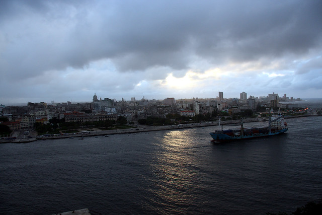
Port Of Havana, Cuba


Port of Havana is the main port in Cuba (not including Guantanamo Bay Naval Base, a territory on lease by the United States). Most vessels coming to the island make port in Havana. Other port cities in Cuba include Cienfuegos, Matanzas, Manzanillo and Santiago de Cuba.

The harbour was created from the natural Havana Bay which is entered through a narrow inlet and which divides into three main harbors: Marimelena, Guanabacoa, and Atarés.

As a harbor almost completely surrounded by shipping and industrial activities, the waters of the bay suffer from environmental stress. This in turn affects the water quality of the Caribbean Sea into which it flows.

Water entering the bay as river flows or effluent from industrial processes has a residence in the harbor of 8 days, on average. It receives approximately 48,000 m3 of waste water per day, which carries about 4,800 kg of nitrogen and 1,200 kg of phosphorus, which results in elevated concentrations of nutrients. Havana Bay is strongly affected by sewage dumping, and it also receives suspended solids, hydrocarbons, heavy metals and pollutants from agriculture, industry and port activities.

The leading sources of pollution in the bay have been identified as the Luyano River which contains organic material, nutrients, sewage, solid waste, the Regla oil refinery, fish hatcheries, and port activities. The high concentration of hydrocarbons, heavy metals and other pollutants is of concern as the harbor is an important fishing port.


Sunday, July 22, 2012

Port Of Montreal, Canada

The Port of Montreal is the second largest city in Canada and the busiest seaport on the St. Lawrence River and Seaway that links the Great Lakes with the Atlantic Ocean. The Port of Montreal is about 267 kilometers southwest of Canada's Port of Quebec and about 335 kilometers northwest of the Port of Portland, Maine, in the United States. Covering about 75% of Montreal Island, the Port of Montreal surrounds Mount Royal rising some 233 meters above sea level. The Montreal metropolitan area contains many cities and towns that rest on both shores of the St. Lawrence River.

In 2006, over 1.6 million people lived in the Port of Montreal, and more than 3.6 million people resided in the greater metropolitan area.


The Port of Montreal boasts the most productive economy in Quebec and the second most productive in Canada. It is a national center for culture, commerce, technology, finance, and technology. Industries in the Port of Montreal include pharmaceuticals, telecommunications, aerospace, software engineering, electronics, printing and publishing, transpiration, and tobacco. The Port of Montreal also supports a strong service sector and a sizeable research and development component. In addition to all this activity, the Port of Montreal is the world's biggest inland port and one of Canada's most important ports as well as a hub for the country's rail network.

In early 1947, the Canadian and U.S. governments started talking about building the St. Lawrence Seaway as a joint venture that was completed in 1959. Unfortunately, the Seaway allowed many vessels to by-pass the Port of Montreal, reducing the Port of Montreal's position of economic dominance.

The popular Expo 67 brought international recognition to the Port of Montreal in 1967. The recognition won the first non-U.S. major league baseball franchise for the Port of Montreal, and the Montreal Expos played ball in the city from 1969 until 2004 when they were moved (as the Nationals) to Washington D.C.

Hosting the Summer Olympics in 1967 proved to be a financial disaster for the Port of Montreal, as it acquired heavy debt burdens for the province. Exacerbating the Port of Montreal's problems, the Quebec separatist movement led many corporations to move their headquarter offices from the Port of Montreal to Toronto during the 1970s and 1980s, largely due to the enforcement of French-language use "guidelines." The Port of Montreal's economy slowed to a near stand-still in the early 1990s, but it began to make gradual improvements when high-technology industries like electronics and aerospace engineering started growing.

In 2002, all 27 municipalities on Montreal Island were merged into one vast city of Montreal. However, several districts did not agree with the merger. All citizens were allowed to vote on the action in 2005, and 15 elected to separate from the megappolis in 2006, becoming once again independent municipalities.


The Montreal Port Authority (MPA), an autonomous federal agency, is responsible for making the Port of Montreal a competitive world-class seaport. The MPA constructs and maintains port infrastructure and leases properties to private stevedoring companies and shipping lines. It also operates a grain terminal, a passenger terminal, and a railway with 100 kilometers of track that serves almost every berth in the Port of Montreal. The MPA's mission is to manage the Port of Montreal's infrastructure, facilitate transportation and logistics, promote trade, contribute to the local and national economies, and respect the environment. Pilotage services are required on the St. Lawrence River between the Les Escoumins pilotage station and the Port of Montreal.

In 2008, the Port of Montreal welcomed 2096 vessels carrying 27 million tons of cargo, including 15.2 million tons of imports and 11.8 million tons of exports. The total cargo volume included 13.3 million tons of containerized cargo in 1.5 million TEUs, 215.6 thousand tons of non-containerized general cargo, 5.5 million tons of dry bulk cargoes, and 8 million tons of liquid bulk cargoes. The Port of Montreal also hosted 41 cruise vessels carrying 39.6 thousand passengers.

The Port of Montreal's containerized cargoes included forest products, foodstuffs, metal products, construction materials, iron and steel products, vehicles and accessories, chemicals, textiles, ores, and a variety of other goods. Non-containerized general cargoes included metal products, roll-on/roll-off cargoes, iron and steel products, granite and sandstone, vehicles and accessories, forest products, and other goods.

Liquid bulk cargoes handled in the Port of Montreal were dominated by gasoline, fuel oil, and diesel oil, but they also included jet fuel and asphalt. Dry bulk cargoes were dominated by included grain and iron ore, but they also included salt, raw sugar, fertilizers, zinc ore, scrap metals, copper ore, gypsum, dolomite, industrial sand, and other commodities. In 2008, the Port of Montreal's international trading partners accounted 21.3 million of the total 27 million tons of cargo passing through the port. The major international partners were the United Kingdom and Continental Europe, the United States, the Mediterranean region, Latin America.

The berths in the Port of Montreal are a total of 11.7 thousand meters in length with alongside depths ranging from 6.1 meters to 10.7 meters, and they contain a total of 885.3 thousand square meters of open areas and 102.2 thousand square meters of sheds.
Berths specializing in handling containers in the Port of Montreal are a total of 3.6 thousand meters long and contain 591.6 thousand square meters of open area. Two container berths in the Bikerdike Terminal are a total 357 meters in length with alongside depth of 8.8 meters, and they contain 9.6 thousand square meters open area). Four berths are located in the Cast Terminal with a total length of 738 meters and alongside depths of 10.7 meters. The Port of Montreal's Cast Terminal also contains 197.1 thousand square meters of open area.

Port Of Portsmouth, England

The Port of Portsmouth is an independent city in southeastern Virginia. Lying across the Elizabeth River about seven nautical miles from the Port of Norfolk, it is part of the natural harbor that makes up the Port of Virginia known as Hampton Roads. The Port of Portsmouth is also about 150 nautical miles south of the Port of Baltimore across the Chesapeake Bay. With a population of over 100,000 in 2006, Portsmouth is home to the Norfolk Naval Shipyard that played an important role in the American Civil War. Today, the navy yard builds and repairs U.S. naval vessels.

The Port of Portsmouth is part of the Hampton Roads military complex and is home to the US Navy's Norfolk Naval Shipyard. The navy yard and military facilities in the Port of Portsmouth are the city's major economic contributors. Other activities also support the local economy. They include manufacturers of fertilizers, chemicals, plastics, and railroad equipment.


Before Europeans arrived in the area of the future Port of Portsmouth, the Powhatan Renape , a confederacy of tribes and a subdivision of the Algonquian Nation controlled the area. These proud peoples sought to drive the encroaching English settlers out of their lands but were unable to do so. Their attacks on Europeans from 1622 to 1644 brought swift reprisals from the English, and by 1646, the Powhatan Confederacy was for the most part destroyed, both by war and by the diseases the English brought with them to the Port of Portsmouth.

Shipbuilder John Wood identified the site of the future Port of Portsmouth as a good location for shipbuilding in 1620. He petitioned Britain's King James I for a land grant, and the area grew up quickly as a plantation community.

The land under Port of Portsmouth was granted in 1676 to British Colonel William Crawford, a rich ship owner and merchant who established the town and named it after Portsmouth, England. The Virginia General Assembly established the Port of Portsmouth by law on behalf of Colonel Crawford. Crawford reserved the intersection of High and Court streets for a market, a church, a jail, and a courthouse.

During the American Revolution, both British and American troops occupied the Port of Portsmouth. In 1767, Scotsman Andrew Sprowle built a shipyard in the Port of Portsmouth that later became the Norfolk Navy Yard owned by the U.S. government. In 1794, the US Congress passed legislation that allowed the government to lease the Port of Portsmouth's Gosport Shipyard from the State of Virginia. Then in 1799, work began on the USS Chesapeake, one of the first six frigates built for the United States.

The Commonwealth of Virginia owned the Port of Portsmouth's Gosport Shipyard after the Revolution and sold it to the federal government of the new United States in 1801 for $12 thousand, making it one of the first federal military installations. Construction of the first Port of Portsmouth dry dock began in 1827. Covering an area of 6.5 hectares in 1801, the area is the northeastern corner of today's Norfolk Naval Shipyard after additional land was added to the facility in 1845.

Virginia joined the Confederate States of America in 1861, and when Union troops evacuated the Port of Portsmouth shipyard, they burned it. They withdrew to Fort Monroe, the only land area in the Hampton Roads area still under Union control. The South found much equipment and scrap left in the Port of Portsmouth that they used to build the Confederate ironclad CSS Virginia , using the hulk of the USS Merrimack as its base. The Virginia fought the Union's USS Monitor in the Battle of Hampton Roads when the Union blockaded Hampton Roads.

In 1862, the Confederate ironclad battled the Union ironclad, the USS Monitor, in the Battle of Hampton Roads in an attempt to end the Union blockade of the Port of Portsmouth and other nearby Virginia ports. While neither side won that battle, the Confederates were defeated later that year. Forced from the Port of Portsmouth in 1862, the Confederates burned the shipyard when they left in 1862.

Port Of Bahia Blanca, Argentina


The Port of Bahia Blanca is a small port in the Buenos Aires province in Argentina. The Bahía Blanca harbor area facilities spread along 25 Km. of the north shore at the Bahía Blanca Channel. Several organizations, national and provincial, have their offices in this area. It is necessary to set their jurisdiction and hence, responsibilities.

The Port Authority can be divided into two areas: land and marine.The land area mainly consists of the harbors of Ingeniero White and Galván, including the interspace, called Cangrejales area. The lots belong to the Port Authority and are outlined in maps 007-50/83, 007-138/83, 007-31/84 and 007-118/87, approved by the Geodesy Department of the Buenos Aires Province.

The marine area consists of both sides of the Bahía Blanca Channel and is a geographic space determined by an imaginary line heading from Pehuen-Có Point (NE) to Laberynth Point (SE), following the general layout of the 10 m isobat and the shoreline of both banks up to the end.

Within the maritime jurisdiction both land and marine areas of Puerto Rosales and the Puerto Belgrano Naval Base still belong to the Provincial State. Its location can be found on the Naval Hydrographic Service Chart # H-212.

Saturday, July 21, 2012

Port of Albany-Rensselaer, USA


The Port of Albany–Rensselaer, widely known as the Port of Albany, is a port of entry in the United States with facilities on both sides of the Hudson River in Albany and Rensselaer, New York. Private and public port facilities have existed in both cities since the 17th century, with an increase in shipping after the Albany Basin and Erie Canal were built with public funds in 1825.

The port's modern name didn't come into widespread use until 1925; the current port was constructed in 1932 under the governorship of Franklin D. Roosevelt and included the largest grain elevator in the world at the time. Today the grain elevator remains the largest in the United States east of the Mississippi River, and the port also hosts the tallest harbor crane in the state of New York.

The port has rail connections with the Albany Port Railroad which allows for connections with CSXT and CP Rail, and is near several interstates and the New York State Canal System. The port features several tourist attractions as well, such as the USS Slater (DE-766), the only destroyer escort still afloat in the United States.

The Port of Albany and the private companies located there bring to the Capital District's economy $428 million in direct spending and 1,382 jobs. The port has a U.S. Customs office as it is a port of entry.

The Albany Port Customs District includes all of the following counties: Albany, Columbia, Delaware, Fulton, Greene, Montgomery, Otsego, Rensselaer, Saratoga, Schenectady, Schoharie, Warren, and Washington; along with the parts of Dutchess, Sullivan, and Ulster counties north of 41° 42' N. latitude. The 35 acres (140,000 m2) on the Rensselaer side of the port is site C of Foreign Trade Zone number 121. A significant amount of the port is part of New York's Empire Zone program, which gives port tenants breaks on state income tax along with various benefits and tax breaks from the city of Albany.

The Port of Albany is roughly 260 miles (420 km) east of Buffalo, 225 miles (362 km) south of Montreal, 175 miles (282 km) west of Boston, and 135 miles (217 km) north of the city of New York which makes it a location for regional distribution in the Northeastern United States and parts of Canada. As part of the Inland Distribution Network, the Port of Albany has a twice-weekly barge service to and from the Port Authority of New York and New Jersey terminals.

Shipments into the port can leave through many modes of transportation, including by truck and rail. Albany International Airport is 15 minutes away with cargo facilities. Canals allow for further water transportation on barges further into the interior of North America. The port also handles commodities that are not carried on ships. Grain, molasses, animal feed, wood pulp, and steel often go from inbound trains to outbound trucks.

Port Of A Coruna, Spain

The Port of A Coruna is an autonomous community of Galicia and the capital of the A Coruna Province in northwestern Spain. It lies at the mouth of the Mero River as it flows into the Atlantic Ocean. Its position near a traditional sea route from Europe to Latin America makes it one of Spain’s most important ports. It is also the second biggest fishing center in Spain. Exports of agricultural produce and imports of coal, manufactured goods, and salt flow through the port on a daily basis.

Complementing its fishing industry, the Port of A Coruna contains canning and salting factories. It is also home to a busy petroleum refining industry and manufacture of textiles, chemicals, aluminum, and machinery. A tobacco factory and shipyards are located in its suburb of Santa Lucia to the south. The Port of A Coruna also has busy beach resorts and a thriving real estate market for second homes. In 2006, over 224 thousand people lived in the Port of A Coruna.


The Port of A Coruna was a base for anti-monarchist sentiments during the 19th Century, and the city supported the liberals throughout the century. In the early 19th Century, the National Factory of Cigarettes was established, which eventually spawned the country’s worker movement. Other industries arrived over the century including manufacturers of textiles, glass, matches, and gas. Still, its position as a seaport and trade center remained strong.

As the 20th Century began, the Port of A Coruna was home to about 45 thousand people. After the Spanish Civil War, former supporters of the Republic were forced to leave the Port of A Coruna, and those who remained suffered at the hands of the Franco government. The Nazis killed 13 citizens of the Port of A Coruna in the Mauthausen-Gusen concentration camp.

After Spain was restored to democracy in 1975, the Port of A Coruna enjoyed new urban renewal projects and a new focus on the tourism and service sectors to expand and diversify its economy.

The Port of A Coruna was born at the dawn of the modern era with the construction of the Hercules Tower, a Roman lighthouse that is still in use today. During the 2nd Century, a village grew up around the tower. By the 13th to 15th Centuries, the Port of A Coruna began to grow outside the old city walls, and the fishing port called la Pescaderia appeared. The San Anton Castle was built in 1528 to protect the port’s entrance.

By 1759, the Port of A Coruna had become the second most important port in the province, with 20 boats operating from the port.

In 1764, Carlos III established a maritime connection between the Port of A Coruna and Havana, Cuba, setting the stage for the Port of A Coruna’s golden age. By 1778, the Port of A Coruna was handling record levels of trade and cargo. In 1867, construction of the first modern dock was approved, and the Muelle de Hierro (Iron Dock) was opened in 1870.

The Junta de Obras del Puerto (Port Works Assembly) was established in 1877 to plan, construct, and improve the Port of A Coruna’s facilities. Five new interior docks were approved in 1892 and completed in 1907. In 1923, the Infanta Isabel, an 8.2 tons vessel of 140 meters, arrived at the Port of A Coruna.

In 1952, the port approved a product to create a 13 thousand meter sheltering dock to protect the port. In 1964, the Refinery Port Terminal was opened, and a third jetty was added to the oil dock in 1973.

In 1977, the Muelle del Centenario (Centenary Dock) was approved to allow the port to accommodate larger modern vessels. Opened in 1982, the Centenary Dock can accommodate vessels up to 120 thousand DWT with draught of 16 meters. To promote fishing activities, several new buildings were added to the Port of A Coruna in 1982-83, including a 1200 square meter fish market. A remodeling project for the fishing port was also approved.

Thursday, July 19, 2012

Port Of Abidjan, Ivory Coast


The Port of Abidjan is the main port and largest city of the Cote d’Ivoire (Ivory Coast) in Africa. Lying on the Ebrie Lagoon, it is linked to the Gulf of Guinea and Atlantic Ocean by the Vridi Plage sandbar. In addition to its seaport, the Port of Abidjan contains an autonomous international airport, making it a communications center for all of the Cote d’Ivoire. The most populous city in Western Africa, it is a commercial and banking center as well as the Cote d’Ivoire’s de facto capital. In 2005, over 3.5 million people called the Port of Abidjan home.


The Port of Abidjan was a small village in 1898 that became a town in 1903. From 1934 until 1960, it was capital of the French colony, with scant port facilities until 1950. In 1950, the city was opened to the sea with the construction of the Vridi Canal. It soon became French-speaking West Africa’s major shipping and financial center.

Although Yamoussoukro was named the country’s capital after independence in 1960, the Port of Abidjan continues to be the country’s commercial and financial center. The modern city contains many gardened squares and wide shady streets. It houses a university established in 1958, several research institutes, a museum of traditional art, a library, and many tourist attractions, including the tropical rainforest, Banco National Park, to the city’s north.

After independence in 1960, the Port of Abidjan was blessed by a long economic boom, becoming the “Paris of Africa” with casinos and world-class hotels. It took on a skyline of skyscrapers and many fashionable shopping areas. Economic decline in the 1990s brought an unfortunately decline in the city’s infrastructure and an increase in pollution. The civil war in the north has brought further economic hardship and chaos to the Port of Abidjan since 1999.


Today, the Port of Abidjan is a gateway to West Africa. It exports cocoa, timber, coffee, pineapples, bananas, and manganese. The Port of Abidjan handled 12 million tons of cargo in 1995. The city’s major industries include coffee, cocoa, food processing, and the manufacture of automobiles, chemicals, textiles, and soap. The Cote d’Ivoire is attempting to bring back ocean-going traffic that began avoiding the port since the 1999 military coup and subsequent political conflicts.


The Port of Abidjan is West Africa’s biggest, most modern port. With a central location and a well-developed infrastructure, it is a major point for transshipments to West and Central Africa over the Cote d’Ivoire’s modern rail and road systems. Since opening of the Vridi Canal, the Port of Abidjan has handled nearly all commercial trade for the Cote d’Ivoire.

Covering water surface of 2500 acres and land area of 50 acres, Port of Abidjan facilities contain warehouses, specialized facilities for handling bananas, logs, and offshore tankers. The Cote d’Ivoire is the third largest cocoa bean exporter in the world. It’s also an important distribution point for imports to Africa. Imports include foodstuffs, machinery, equipment, pharmaceuticals, and manufactured goods going to the south. Exports include rubber, cotton, timber, fruit, fish, vegetables, and cocoa.

Quickly becoming one of West Africa’s most important fishing ports, the Port of Abidjan includes fleets of trawlers and sardine and tuna fishing boats. Over 200 thousand tons of fish are processed there each year.
With a total of six kilometers of quay, the Port of Abidjan has 34 berths including berths dedicated for timber, cereals, fruits, petroleum products, and containers. Dept at the harbor’s mouth is 10.5 meters, and the dept is 12.5 meters at the quays. The Port of Abidjan can accommodate vessels up to 260 meters long. The port contains 407.6 thousand square meters of open storage and 143.5 square meters of covered warehouses and sheds. Three berths specialize in container-handling, and one berth is devoted to roll-on/roll-off cargoes. All of the port’s wharves are connected to the rail network.

Port Of Nagoya, Japan

The Port of Nagoya is the capital of Aichi Prefecture in east central Japan. It is also one of the country's busiest industrial centers. Located at the head of Ise Bay off the Pacific Ocean, the Port of Nagoya is about 20 kilometers northwest of the Port of Kinuura and almost 140 kilometers east-northeast of the Port of Osaka. The Port of Nagoya is Japan's third biggest incorporated city and its fourth most populous metropolitan area. In 2005, the Port of Nagoya was home to over 2.2 million people, and more than 8.7 million people live in the metropolitan area.

The Port of Nagoya is one of the country's busiest and most important ports. The city's central location and its abundant hydroelectric power have stimulated heavy industry in the region. The Port of Nagoya's traditional industries produced timepieces, sewing machines, and bicycles. Modern industries produce chemicals, special steels, oil, and petrochemicals. Shipbuilding, aviation, and automotive industries have also flourished in the Port of Nagoya.

The Nagoya Port Authority was established by Aichi Prefecture and Nagoya City in 1951. Regulated by the Port and Harbor Law, the Nagoya Port Authority is the port administrator responsible for planning, constructing, and improving port infrastructure and facilities; maintaining and managing the port area to assure efficient operations; and conducting public works required for use of the port. Private interests provide stevedoring services, preserve the water surface, and manage intra-harbor traffic in the Port of Nagoya.

The modern Port of Nagoya opened for international trade in late 1907, and today, it has trade partnerships with about 150 countries. The biggest port in Japan for cargo throughput, the Port of Nagoya handles all types of cargo. It is one of Japan's five major ports (with Tokyo, Yokohama, Osaka, and Kobe), handling about 11% of the country's total trade value and accounting for some 62% of Japan's trade surplus. The Port of Nagoya is the first automobile exporting port in the country, exporting almost two million finished automobiles each year.

In 2008, the Port of Nagoya handled a record 218 million tons of cargo, including 138 million tons of international trade, with growing exports in automobile parts, industrial machinery, and rubber products and increasing imports of liquefied natural gas and ore. The Port of Nagoya handled over 46.5 million tons of containerized cargo in 2.6 million TEUs, almost equally divided between exports and imports.

The Port of Nagoya served a total of over 38.7 thousand vessels in 2008, including almost 4.4 thousand container ships, 8.9 thousand ocean-going vessels, and 29.8 coastal vessels. Of the total 218.1 million tons of cargo, 138.2 million tons was international cargo, and 79.9 million tons was domestic cargo. International cargoes handled by the Port of Nagoya included 81.4 million tons of imports and 56.8 million tons of exports. Handling a total of more than 2.8 million TEUs of containerized cargo in 2008, the Port of Nagoya handled over 2.6 million TEUs of international containers and 186.3 thousand TEUs of domestic containers.

The Port of Nagoya is approached through three major channels. The East Channel is 10 kilometers long, 500-610 meters wide, and 15 meters deep. The West Channel is 8.4 kilometers long, 350-400 meters wide, and from 12-15 meters deep. The Port of Nagoya's North Channel is five kilometers long, 200-400 meters wide, and from 10-12 meters deep. The Port of Nagoya plans to further dredge and expand the East and West Channels to accommodate the increasing size of container ships.

In the Port of Nagoya's Inner Port are four mooring buoys. Three buoys can accommodate two 27 thousand DWT vessels, and one buoy can accommodate one 20 thousand DWT vessel. The West Seafront Area contains eight buoys. Two sets of four buoys can each accommodate three 15 thousand DWT vessels.

The Port of Nagoya is also served by three major canals. The Nakagawa Canal is 8.4 kilometers long, from 35-63 meters wide, and 2.6 meters deep. The Hori-kawa Canal is 10.1 kilometers long, 17 meters wide, and 1.8 meters deep. The Shin Hori-kawa Canal is almost 5.7 kilometers long, 17 meters wide, and 2.2 meters deep.

The Port of Nagoya contains a total of 287 berths (with a depth of 4.5 meters and over) with a total length of more than 34.7 kilometers. Of those 287 berths, 127 are public berths, 151 are private berths, and nine are owned and operated by Public Corporation, NCB, Tobishima Pier South Side.

The Port of Nagoya also contains over 275.6 hectares of warehouses, 53.2 hectares of sheds, 73.3 hectares of cargo-handling yards, 22.5 hectares of coal yards, 234.7 hectares of timber yards, and 341.1 hectares of open storage yards. The Nagoya Port Authority operates 154.8 thousand square meters of sheds and 733.2 thousand square meters of cargo-handling yards, while the remaining storage areas in the Port of Nagoya are operated by private interests. The Port Authority also operates 212.5 hectares of timber yards and 97.3 thousand square meters of open storage.

The Port of Nagoya's six container terminals cover a total area of 151 hectares and contain 14 berths with a total length of 4105 meters with depths from 10 to 15 meters. They have combined box capacity for 72.9 thousand TEUs and throughput capacity for a total of almost 2.9 million TEUs. They also contain a total 1007 reefer plugs. Four of the container terminals operate at the Tobishima Pier, forming the Port of Nagoya's biggest container center.

There are two public container terminals at the Port of Nagoya's Tobishima Pier. With throughput capacity for over 493 thousand TEUs, the South Terminal covers an area of 22.5 hectares. It has two berths of 700 meters with alongside depth of 15 meters. The South Terminal has box capacity for over 15.9 thousand TEUs and includes 140 reefer plugs. The Port of Nagoya's North Terminal contains three berths with a total length of 620 meters and depths from 10 to 12 meters. Covering 17 hectares, the North Terminal has box capacity for 6.2 thousand TEUs, 110 reefer plugs, and throughput capacity for over 349.2 thousand TEUs.